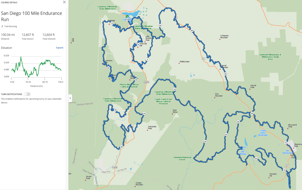
The SD 100 course covers five major areas: Mt Laguna Recreational Area, Pacific Crest Trail(PCT), Noble Canyon and Indian Creek Trails, Rancho Cuyamaca State Park, and Lake Cuyamaca. Course Maps, Elevation Profiles, Aid Station Locations, Detailed Turns, Crew Access, Mandatory Cut-off Times, and Pacer Allowed Legs can be found below. Pay close attention to applicable course markings and review the overall course map to have the big picture of the course. There have been instances, of course, marking vandalism in past races. As such, we recommend carrying a copy of the course maps and/or detailed route directions for sections that you are unfamiliar with.
Here is the information for the 2027 course in PDF/GPX format:
and here is a link to the GPX file with an interactive map on Garmin:
San Diego 100 Endurance run on Garmin
Below are summaries of the information in the PDF files; however, the above PDFs are the “official” records and may be updated in the upcoming months, so please check these for any revisions.
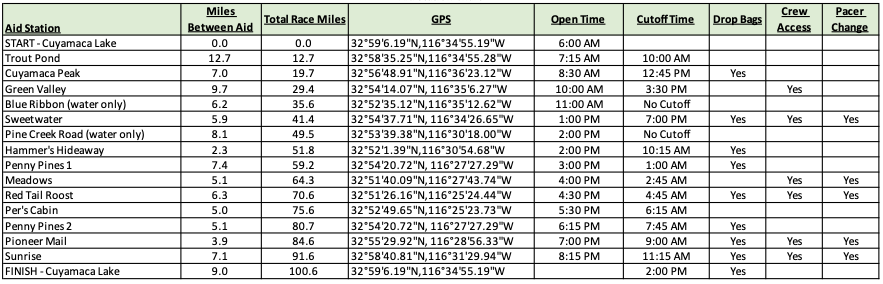
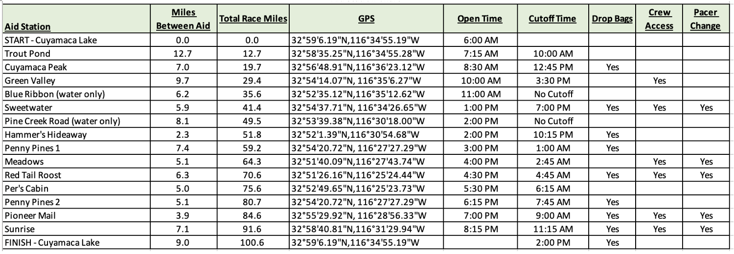
(1) Here is the final table of aid stations (with cut-offs) for the 2027 event. To download the file, either click on the link above or directly on the image.
(2) The maps file gives 13 pages of glorious detail of where we’ll be running. Here’s an example page showing the overall course location:

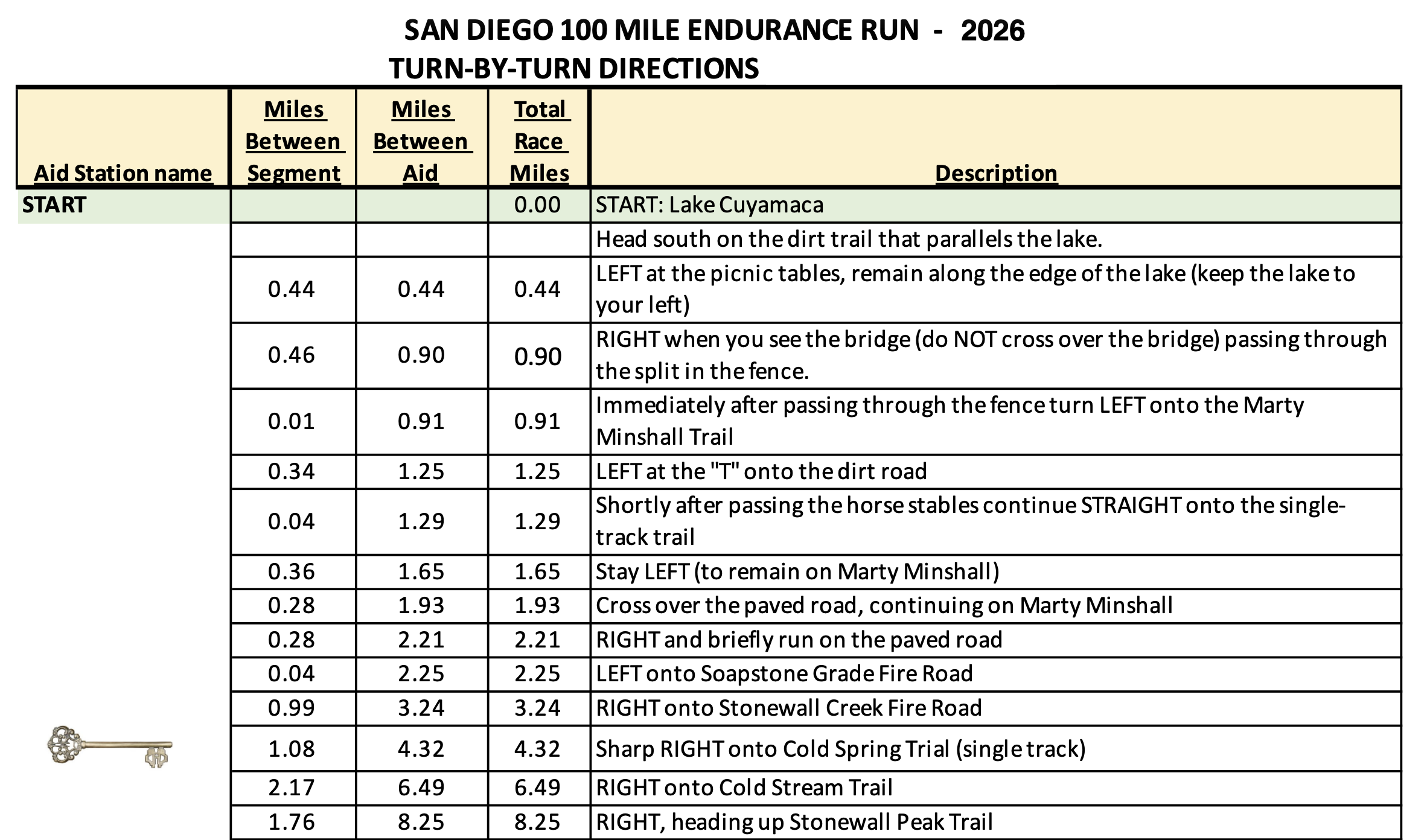
(3) The turn-by-turn map goes into excruciating detail for every turn on the course. Here’s an example that gets you to the first aid station at Trout Pond (no, we probably won’t be serving fried fish for breakfast!):
(4) And finally, the GPX file, which you can install on your watch, can also be viewed interactively at Garmin’s connect website: